
Annapurna Circuit Trek Difficulty: Complete Guide by Section
The Annapurna Circuit Trek is rated moderate to challenging. The difficulty comes from altitude, long duration, and terrain rather than technical climbing skill, with the trek's highest point at Thorong La Pass, 5,416 m (17,769 ft). Trekkers typically walk 5 to 8 hours a day for 12 to 18 days, crossing multiple climate zones before descending into the rain-shadow valleys of Mustang.
The challenge builds gradually rather than hitting all at once. Lower sections through the Marsyangdi Valley and the Annapurna massif's eastern approach are physically tiring but not altitude-heavy. From Chame onward, altitude begins to shape breathing, pace, and recovery, and the section above Manang is where most trekkers feel the clearest shift in effort. No ropes, crampons, or mountaineering equipment are needed under normal conditions — what the trek demands instead is sustained fitness, careful pacing, and proper acclimatization.
Quick Difficulty Summary
The Annapurna Circuit Trek is moderate to challenging, with its hardest point at Thorong La Pass (5,416 m). No technical climbing skills are required, but the combination of altitude, distance, and duration makes it a serious undertaking.
Factor | Details |
| Difficulty level | Moderate to challenging |
| Highest point | Thorong La Pass: 5,416 m (17,769 ft) |
| Trek duration | 12 to 18 days depending on itinerary |
| Total distance | 160 to 230 km (99 to 143 miles) |
| Daily walking hours | 5 to 8 hours |
| Daily distance | 7 to 18 km |
| Technical skills required | None |
| Key acclimatization stop | Manang, 3,519–3,540 m |
| Hardest day | Thorong Phedi/High Camp to Muktinath via Thorong La Pass |
Why Is the Annapurna Circuit Trek Difficult?
No single factor makes this trek hard. Difficulty comes from several elements compounding over nearly two weeks on the trail.
Altitude is the main driver: as elevation rises, reduced oxygen affects breathing, sleep, appetite, and recovery. Cumulative fatigue builds because the body rarely fully recovers between consecutive walking days at altitude. Terrain variety adds physical demand, shifting from subtropical valley floors to alpine desert within the same route. Weather and temperature swing sharply across climate zones, from humid lower valleys to freezing, wind-exposed high terrain. Above Manang, teahouse lodging becomes more basic, and altitude affects sleep regardless of comfort. All of this adds a mental-endurance component on top of the physical one — staying motivated through early starts, weather delays, and the slower pace altitude demands.
Altitude: The Main Difficulty Factor
Altitude is the single most important reason the Annapurna Circuit becomes difficult. As atmospheric pressure drops with elevation, the amount of oxygen available to the body decreases, directly affecting cardiovascular efficiency, muscle recovery, sleep quality, appetite, walking speed, and mental focus. Near Thorong La Pass, oxygen availability drops to roughly 47 to 54 percent of sea-level levels. Even well-prepared, physically fit trekkers can struggle at this altitude, because aerobic performance declines significantly regardless of fitness on flat ground.
Elevation Range | Physiological Effects |
| 2,500–3,500 m | Faster breathing, mild fatigue |
| 3,500–4,500 m | Reduced sleep quality, slower recovery |
| Above 4,500 m | Significant breathlessness, energy loss |
Terrain Changes and Cumulative Fatigue
The trail surface changes continuously across the route: stone stairs and farmland in the lower valleys, forest and ridge trails through the mid-elevations, rocky alpine terrain in the upper valley, and loose scree, snow, or ice near the pass itself. Each terrain type asks something different of the body. Stone steps drive quadriceps fatigue, steep descents stress the knees, rocky paths increase ankle-instability risk, and snow or ice slows movement and raises slip risk. Combined with 5 to 8 hours of daily walking across 10 to 18 days, this fatigue accumulates — the body rarely fully recovers overnight once altitude is added to the equation, and the cumulative effect becomes most noticeable after Manang.
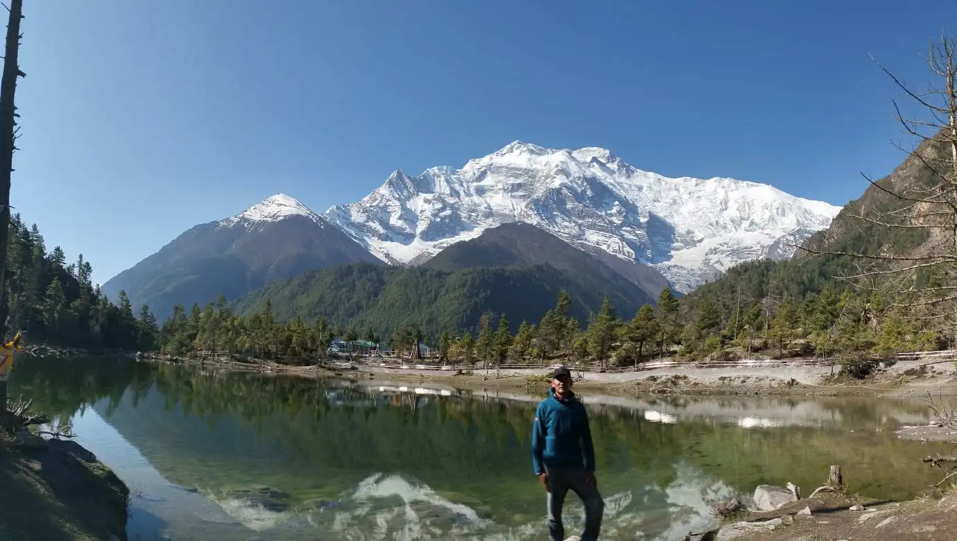
Weather and Seasonal Difficulty
Weather conditions strongly affect how hard the trail feels on any given day, and the same route can range from comfortable to genuinely tough depending on the season.
Season | Months | Conditions | Difficulty Impact |
| Spring | March–May | Mild temperatures, mostly dry and stable | Moderate |
| Monsoon/Summer | June–August | Warm, humid lower regions; muddy, slippery, landslide-prone trail | High |
| Autumn | September–November | Stable temperatures, dry trail, excellent visibility | Moderate (best overall conditions) |
| Winter | December–February | Very cold above 3,500 m, snow-covered and icy upper sections | High; pass may close in poor years |
Areas around Thorong Phedi, High Camp, and the pass itself can see sudden snowfall, strong winds, ice-covered trail, rapid temperature drops, and whiteout visibility even in otherwise stable seasons, all of which increase physical effort and reduce walking efficiency.
Difficulty by Route Section
Difficulty is not uniform across the Annapurna Circuit — some stretches are genuinely easy, and others test even experienced trekkers. Breaking the route into sections makes it easier to know where to expect the biggest jump in effort.
Besisahar/Bhulbhule to Chame
Difficulty: Easy to Moderate. The opening section follows the Marsyangdi Valley through warm villages, terraced farmland, river trails, and suspension bridges. Altitude is low and not yet a factor, but repeated stone steps and long walking hours still cause real fatigue. Many trekkers move too fast here because the body is still coping well — that early overconfidence is a common pacing mistake that costs energy later in the trek. Parts of this lower section now follow jeep tracks where road construction has altered the traditional trail, adding dust and occasional vehicle traffic. By Chame (around 2,800 m), the body is beginning its first mild introduction to thinner air.
Chame to Manang
Difficulty: Moderate. The trail opens into wider valley views of the Annapurna and Lamjung ranges as elevation gain becomes more consistent. Two route options exist between Pisang and Manang: a shorter, less strenuous lower road route, or a harder upper trail via Upper Pisang, Ghyaru, and Ngawal that climbs significantly higher through traditional high-altitude villages with sustained ridge walking. The upper route is more rewarding for trekkers acclimatizing well, while the lower route suits those already feeling altitude effects. By Manang (3,519–3,540 m), many trekkers notice their first mild AMS symptoms — headache, reduced appetite, or shallower sleep.
Manang Acclimatization Day
A rest day in Manang is a standard, essential part of nearly every Annapurna Circuit itinerary, and it functions as the trek's turning point. Below Manang, most trekkers move at a comfortable pace without significant altitude disruption; above it, the relationship between effort and outcome changes. The purpose of the stop is active acclimatization rather than passive rest — climbing higher during the day and returning to sleep lower, following the standard "climb high, sleep low" principle. Optional hikes from Manang range from short viewpoints above the village to the more demanding Ice Lake route at around 4,780 m, which should only be attempted while acclimatizing well. Skipping this rest day is possible but meaningfully increases the risk of altitude sickness on the approach to the pass.
Manang to Thorong Phedi or High Camp
Difficulty: Moderate to Challenging, rising to Challenging. Above Manang, the trail enters open, sparsely vegetated terrain, and altitude effects become more apparent even on days with relatively short distances. The route passes through Yak Kharka and Ledar before reaching Thorong Phedi (roughly 4,420–4,525 m). From here, trekkers choose between sleeping at Phedi or continuing higher to Thorong High Camp (around 4,925 m). High Camp shortens the pass-day ascent but isn't automatically the better choice — it only makes sense for trekkers who are already acclimatizing well and feeling strong; sleeping lower at Phedi may give a better night's rest but means a longer, tougher summit morning. Reduced appetite and disrupted sleep are common in this section, and both matter because the body needs fuel for the pass crossing ahead.
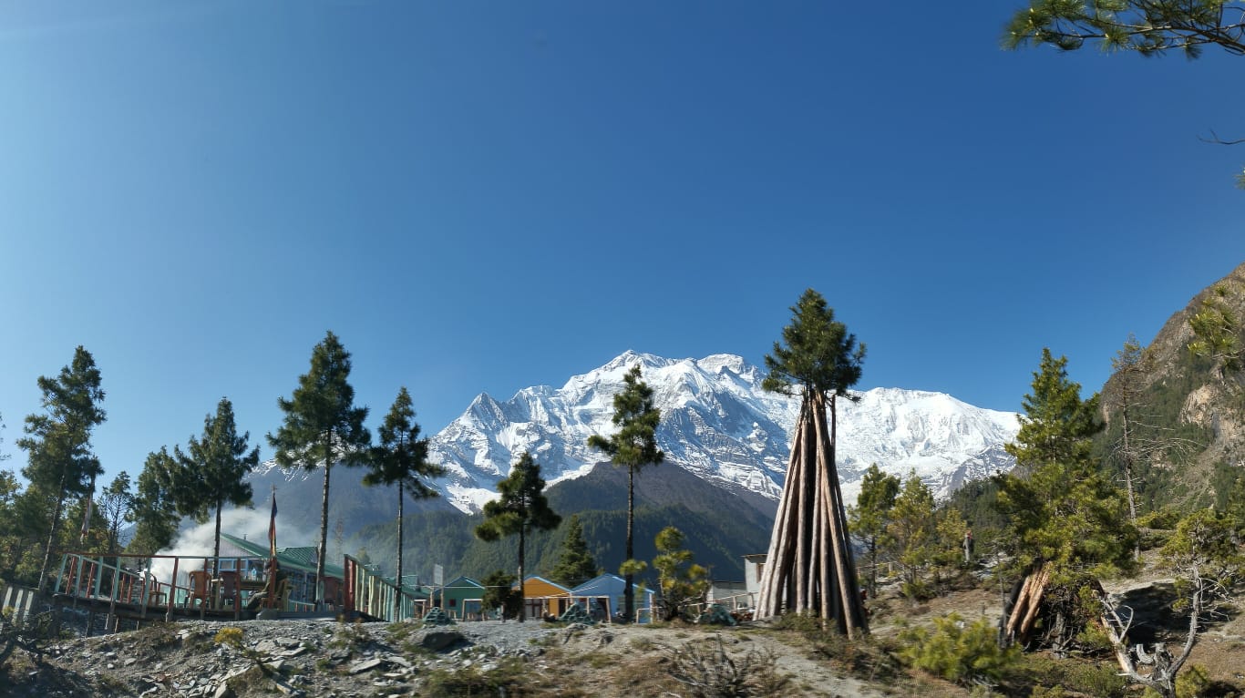
Thorong Phedi/High Camp to Thorong La Pass to Muktinath
Difficulty: Very Challenging. This is the hardest day of the Annapurna Circuit. The ascent begins well before dawn, typically between 3:00 and 5:00 AM, to reach the pass before afternoon winds arrive and to allow enough daylight for the full descent. The climb gains roughly 1,000 m from Thorong Phedi, over steep sections with loose scree and, depending on the season, snow or ice underfoot. Cold pre-dawn temperatures, thin air, and fatigue accumulated from previous days combine to make this the most physically and mentally demanding stretch of the trek.
Reaching the pass isn't the end of the effort. The descent to Muktinath (3,760 m) drops roughly 1,600–1,680 m, and many trekkers find it harder on the knees and legs than the ascent itself, particularly after the exertion of the climb. Trekking poles are strongly recommended to protect the knees on this stretch.
Muktinath to Jomsom, Tatopani and Ghorepani
Difficulty: Easy to Moderate after the pass, though the effort doesn't disappear entirely. Once past Thorong La, altitude is no longer the primary challenge, and the trail descends into the Mustang valley through riverbed walking, dusty jeep roads, and exposed stretches subject to strong afternoon winds funneling through the Kali Gandaki gorge. For itineraries that continue the classic route toward Tatopani and Ghorepani, the climb from Tatopani (roughly 1,190 m) up to Ghorepani (roughly 2,860 m) is one of the most physically demanding lower-altitude sections of the whole circuit, involving long, knee-testing stone staircases on already-tired legs. The optional pre-dawn climb to Poon Hill (3,210 m) is short but steep, rewarding trekkers with sunrise views of the Annapurna and Dhaulagiri ranges.
Thorong La Pass Difficulty Explained
Thorong La Pass is the highest point and hardest day of the Annapurna Circuit, and several factors combine to make it harder than the elevation number alone suggests.
The ascent starts well before dawn to avoid afternoon winds and secure enough daylight for the descent, meaning trekkers begin their hardest day already tired from disrupted high-altitude sleep. Temperatures at the pass can drop well below freezing before sunrise, and wind significantly increases exposure and heat loss. Above roughly 4,880 m, oxygen availability is much lower than at sea level, making sustained effort noticeably harder — trekkers who set off too fast in the early climb often struggle more as they near the pass, so controlled, consistent pacing matters more than speed. Depending on the season, sections between Thorong Phedi and the pass may carry snow or ice, generally manageable in spring and autumn but significantly more serious in winter. The long, steep descent to Muktinath afterward places heavy load on the quadriceps and knees, and trekking poles combined with a measured pace help protect both joints and footing on the loose terrain.
Altitude Sickness (AMS) Risk on the Annapurna Circuit
Acute Mountain Sickness is a genuine risk on the Annapurna Circuit, occurring when the body cannot adjust quickly enough to reduced oxygen at altitude. It becomes a meaningful concern above roughly 3,000 m, with the highest risk zone above 3,500 m.
Common symptoms include persistent headache, nausea or vomiting, dizziness or light-headedness, loss of appetite, poor sleep quality, and unusual tiredness that doesn't resolve with rest. AMS does not discriminate by fitness level — strong, experienced trekkers can develop symptoms while less fit trekkers acclimatize well, because the key variable is the pace of ascent, not physical condition.
Altitude Zone | Elevation Range | Risk Level |
| Early Risk Zone | 2,500–3,500 m | Mild symptoms possible if ascent is too fast |
| High Risk Zone | 3,500–4,500 m | Manang is the critical adaptation point; symptoms more common above this elevation |
| Very High Risk Zone | 4,500 m and above | Oxygen drops sharply near Thorong Phedi and the pass; all symptoms must be taken seriously |
Do You Need Technical Climbing Skills?
No. The Annapurna Circuit is not a technical trek in normal seasons. No ropes, crampons, or mountaineering equipment are needed. What the trek does require is solid basic fitness, mental patience, respect for altitude, the ability to walk long hours over many consecutive days, and good pacing judgment — demanding, but accessible to prepared beginners.
What Fitness Level Do You Need?
Trekkers should be comfortable walking 5 to 8 hours on varied terrain without significant strain at low elevation before arriving in Nepal — if that feels hard at home, it will feel considerably harder at altitude with a pack. Six to eight weeks of preparation makes a meaningful difference. Useful training includes:
- Regular long walks and day hikes, gradually increasing distance
- Stair climbing with a loaded daypack to condition the knees and build endurance
- Cardio work such as running, cycling, or swimming to build aerobic capacity
- Uphill hiking on uneven terrain to simulate real trail conditions
- Leg strengthening exercises: squats, lunges, step-ups
Consistency matters more than intensity — regular training over two months beats a few intense sessions right before departure. Packing light also matters: a heavier bag makes every uphill section harder and increases fatigue across the whole trek, and porter support can meaningfully reduce physical strain in the high sections.
Who May Find the Annapurna Circuit Trek Difficult?
Certain trekkers are more likely to find the circuit significantly harder than average:
- Trekkers with no previous multi-day hiking experience, who may underestimate cumulative fatigue
- Travelers arriving directly from sea level within a day or two of starting, giving the body little time to begin adjusting
- Trekkers on rushed itineraries under 14 days that cut acclimatization stops, raising altitude sickness risk around and above Manang
- Trekkers carrying heavy personal packs without porter support, who feel the extra weight most in the high sections and the long pass descent
- Anyone attempting the pass crossing in winter, facing snow, ice, reduced daylight, and possible trail closure
- Trekkers adding side trips like Tilicho Lake to an already full itinerary without accounting for the added effort
Does Tilicho Lake Make the Trek Harder?
Yes. Adding Tilicho Lake to the Annapurna Circuit typically adds 3 to 4 extra days, more uphill walking, and more exposure to high-altitude terrain. It's a spectacular side trip, but it genuinely raises the physical demand of the overall journey — skipping it keeps the circuit as comfortable as reasonably possible, while adding it suits trekkers seeking a longer, more adventurous high-altitude experience.
Common Comfort Challenges on the Trail
Not every difficulty on the Annapurna Circuit is physical. Trekkers should expect basic toilets in higher villages, limited internet or mobile signal, simpler food options at altitude, colder sleeping conditions, and generally poorer sleep above 4,000 m. None of this makes the trek technically harder, but it does affect morale and recovery, especially cumulatively after several long days.
Travel Insurance for the Annapurna Circuit
Because the trek reaches high altitude, travel insurance matters — particularly coverage for emergency helicopter evacuation, medical expenses, accidents, and delay or disruption. Insurance doesn't reduce the physical difficulty of the trek itself, but it substantially reduces the risk around it, which matters on a route where altitude sickness or injury can require evacuation.
Annapurna Circuit Trek Difficulty vs. Everest Base Camp Trek
Both treks are rated moderate to challenging, and neither requires technical climbing skill, but they present difficulty differently. The Annapurna Circuit is longer overall — 160 to 230 km against roughly 130 km for Everest Base Camp — spread across 12 to 18 days rather than 12 to 14, which means more cumulative fatigue over a longer trip. Its gradual ascent profile, starting from very low altitudes, gives more natural time to acclimatize before the Thorong La Pass crossing. Everest Base Camp, by contrast, gains altitude more steeply in places relative to its shorter overall length. Neither trek is inherently "harder" than the other in every respect; the Annapurna Circuit demands more sustained endurance over time, while EBC compresses a comparable altitude challenge into a shorter window.
Frequently Asked Questions About Annapurna Circuit Trek Difficulty
How difficult is the Annapurna Circuit Trek?
The trek is rated moderate to challenging. Difficulty comes from altitude, long duration, and terrain rather than technical climbing skill, with Thorong La Pass (5,416 m) as the hardest point.
What is the hardest day on the Annapurna Circuit?
The hardest day is the crossing from Thorong Phedi or High Camp over Thorong La Pass down to Muktinath — a pre-dawn ascent through thin, cold air followed by a long, steep descent.
Do you need prior trekking experience for the Annapurna Circuit?
Prior experience isn't required, but it helps. Fitness, pacing, and proper acclimatization matter more than previous trekking experience for a safe, successful crossing.
How cold does it get at Thorong La Pass?
Temperatures at the pass can drop well below freezing before sunrise, and strong wind significantly increases the effect of the cold through added heat loss.
Is the Annapurna Circuit harder than Everest Base Camp?
Not straightforwardly. The Annapurna Circuit is longer and involves more cumulative fatigue over more days, while Everest Base Camp gains altitude more steeply relative to its shorter length. Both are rated moderate to challenging.
Can beginners do the Annapurna Circuit Trek?
Yes, with proper preparation. The trek isn't technically demanding, and beginners who train adequately, pace carefully, and acclimatize properly can complete it successfully.
What causes altitude sickness on the Annapurna Circuit?
Altitude sickness is caused primarily by ascending too quickly for the body to adjust to reduced oxygen, not by low fitness level. Risk rises meaningfully above 3,500 m, making the pace of ascent the key controllable factor.
About the Author
