
Where Is Mount Everest Located? Country, Location, Map & Height Explained
Mount Everest is located on the border between Nepal and the Tibet Autonomous Region of China, in the Mahalangur Himal sub-range of the Himalayas, at approximately 27.9881° N, 86.9250° E. It is the highest mountain on Earth above sea level, known locally as Sagarmatha in Nepal and Chomolungma in Tibet.
Despite being the most famous mountain in the world, its exact location still confuses a lot of people. Is it in Nepal, in China, or somewhere in between? The short answer is both: the summit sits directly on the international border, so neither country can claim it alone. This guide breaks down exactly where Everest sits, which regions and districts it belongs to on each side, how it got its name, how tall it really is, and how to reach it depending on which country you start from.
Where Is Mount Everest?
Mount Everest sits on the border between Nepal and China's Tibet Autonomous Region, in the Mahalangur Himal sub-range of the Himalayas. It is the highest point on Earth at 8,848.86 metres (29,031.7 feet).
- Country: Nepal (south side) and China / Tibet Autonomous Region (north side)
- Mountain range: Himalayas, Mahalangur Himal sub-range
- Height: 8,848.86 m / 29,031.7 ft
- Coordinates: 27.9881° N, 86.9250° E
- Local names: Sagarmatha (Nepal), Chomolungma (Tibet)
Which Country Is Mount Everest In Nepal or Tibet (China)?
Mount Everest isn't fully inside one country. The China–Nepal border runs directly across the summit point, meaning the mountain is physically shared by both nations. On the Nepal side, Everest lies within Sagarmatha National Park, in the Solukhumbu District of Koshi Province. On the Chinese side, it falls within the Qomolangma National Nature Reserve, in Tingri County, part of the Xigazê (Shigatse) Prefecture of the Tibet Autonomous Region.
In practice, this means climbers, trekkers, and researchers approach Everest from two very different directions a lush, village-dotted trekking route through Nepal, or a drier, road-accessible route through Tibet and each country manages its own permits, base camp, and regulations for its half of the mountain.
Mount Everest's Exact Coordinates and Border Location
The summit of Mount Everest sits at roughly 27° 59′ 9.8″ N, 86° 55′ 21.4″ E (27.9881° N, 86.9250° E in decimal degrees). This point marks the exact spot where the Nepal–China border passes over the mountain. Everest's height is measured from the geoid, a model that approximates global sea level even though the nearest actual sea, the Bay of Bengal, lies almost 700 km away.
Everest's Location Within Nepal (Solukhumbu District, Koshi Province)
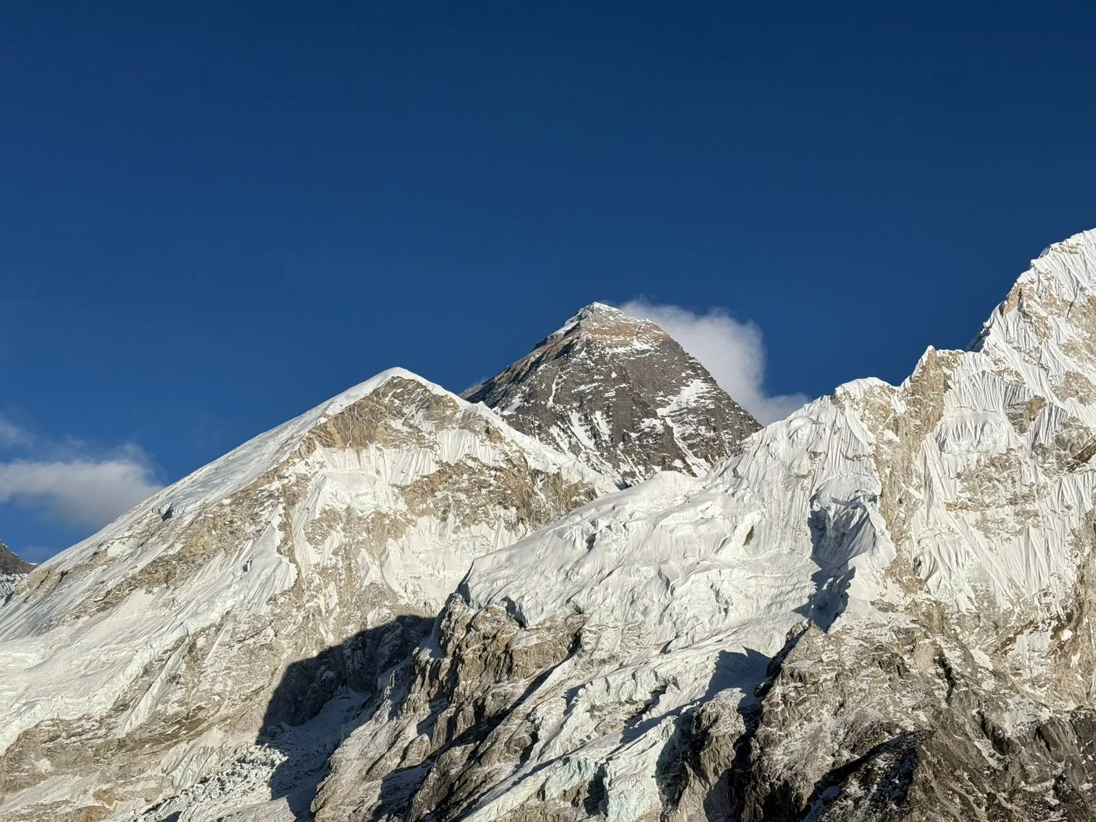
On the Nepal side, Everest lies within the Khumbu Pasang Lhambu Rural Municipality, in the Solukhumbu District of Koshi Province, inside Sagarmatha National Park. Most visitors reach this side by flying from Kathmandu to Lukla, then trekking north through Namche Bazaar toward Base Camp, the classic Everest Base Camp trekking route.
Everest's Location Within Tibet/China (Tingri County, Xigazê Prefecture)
On the Chinese side, Everest sits in Tingri County, within the Xigazê (Shigatse) Prefecture of the Tibet Autonomous Region, protected as part of the Qomolangma National Nature Reserve. This side is reached overland from Lhasa, and unlike the Nepal approach, a road runs almost all the way to North Base Camp.
What Continent and Mountain Range Is Mount Everest In?
Mount Everest is in Asia, standing in the Himalayan mountain system that stretches across the continent's southern belt. Specifically, it belongs to the Mahalangur Himal, a sub-range of the Great Himalayas. Everest is one of fourteen "eight-thousanders" mountains that rise above 8,000 metres and every one of them is located in Asia, mostly along the Nepal–Pakistan–China stretch of the Himalaya and Karakoram ranges.
Is Mount Everest Located in India or Pakistan? (Common Misconception)
Mount Everest is not located in India or Pakistan. It's easy to see why people ask: India borders Nepal, and Pakistan is home to K2, the world's second-highest mountain, which sometimes gets confused with Everest. But Everest sits entirely within the Nepal–China border zone, roughly 175 km from the nearest edge of India. Under exceptionally clear conditions after major storms, its peak has occasionally been spotted faintly from the plains of Bihar but that's the closest India ever gets to it. K2, meanwhile, is in Pakistan's Karakoram range, a separate mountain system entirely.
How Mount Everest Got Its Name
Before it was called Everest, the mountain was simply known to British surveyors as "Peak XV." In 1802, the British launched the Great Trigonometrical Survey of India to measure the region's highest peaks. Nepal wouldn't allow British surveyors to enter the country, so teams worked from a distance, using giant theodolites from stations over 200 km away.
In 1852, Indian mathematician Radhanath Sikdar, working at the survey's Dehradun headquarters, was the first to calculate using trigonometry that Peak XV was the highest point on Earth. After years of verification, Andrew Waugh, the British Surveyor General of India, announced the finding in 1856. Unable to confirm a single local name for the peak, Waugh proposed naming it after his predecessor, Sir George Everest. The Royal Geographical Society officially adopted the name "Mount Everest" in 1865.
Local Names: Sagarmatha and Chomolungma
Long before the British named it, the mountain already had names in the languages of the people who lived near it. In Nepali and Sanskrit, it's called Sagarmatha, meaning "goddess of the sky" or "head in the great blue sky." In Tibetan, it's Chomolungma (also spelled Qomolangma), meaning "holy mother." China's official name, Zhumulangma Feng, is simply a phonetic transcription of the Tibetan name into Mandarin.
How High Is Mount Everest? Official Height & Measurement History
Mount Everest's officially recognised height is 8,848.86 metres (29,031.7 feet), a figure jointly announced by Nepal and China in December 2020 following a new GPS-based survey. That figure isn't final, either Everest is still growing. The collision of the Indian and Eurasian tectonic plates continues to push the summit upward by roughly 4 mm a year and shift it slightly northeastward.
The height has been recalculated many times over the past 170 years. Andrew Waugh's original 1856 estimate put it at 8,840 m. A 1955 Indian survey found 8,847.73 m, and a Chinese measurement in 2005 recorded 8,844.43 m but that figure measured the exposed rock rather than the snow cap on top. In 2010, Nepal and China agreed to recognise both figures for their respective purposes, before settling on the current joint measurement in 2020.
Mount Everest Height in Feet, Meters, and Kilometers
- Meters: 8,848.86 m
- Feet: 29,031.7 ft (29,031 ft 8½ in)
- Kilometers: 8.85 km
Where Is Mount Everest on a Map? (Location Overview)
On a map of Asia, Mount Everest sits roughly midway between Kathmandu, Nepal's capital, and Lhasa, the capital of Tibet, the two nearest cities with major international airports. It lies in the central-eastern stretch of the Himalayas, between the Indian subcontinent to the south and the Tibetan Plateau to the north. The nearest sea, the Bay of Bengal, is almost 700 km to the south, a useful reference point for understanding just how far inland and how high above any coastline the mountain actually sits.
Mount Everest's Neighboring Peaks and the Mahalangur Himal Sub-Range
Everest doesn't stand alone; some of the world's other highest mountains crowd around it in the Mahalangur Himal. Nearby peaks include Lhotse (8,516 m), the world's fourth-highest mountain, along with Nuptse (7,855 m), Changtse (7,580 m), and Khumbutse (6,636 m). On the southwest side, the Khumbu Icefall and Khumbu Glacier form a dramatic, dangerous obstacle that both climbers and trekkers have to navigate on the approach to Base Camp.
Geology: What Is Mount Everest Made Of?
Geologists divide Mount Everest into three rock formations, stacked like layers of a cake and separated by low-angle faults. From the summit down, these are the Qomolangma Formation, the North Col Formation, and the Rongbuk Formation.
The Qomolangma Formation, the rock at the very top of Everest, is made of Ordovician limestone, formed roughly 460 million years ago on an ancient seabed. That's why climbers have found microscopic marine fossils, including trilobites and crinoids, embedded in rock near the summit, solid proof that the highest point on Earth was once under the ocean. The whole mountain exists because of the ongoing collision between the Indian Plate and the Eurasian Plate, which began roughly 50 million years ago and continues to push the Himalayas upward today.
Climbing Routes and Base Camps by Country
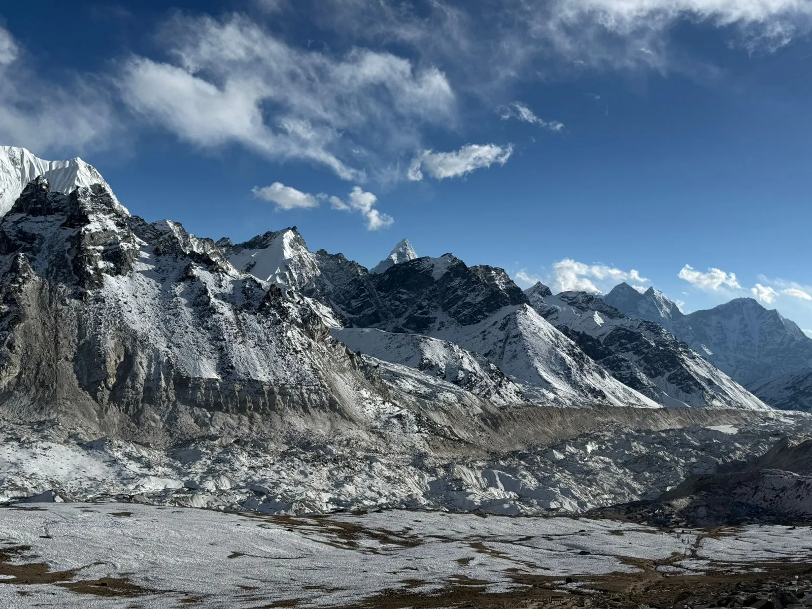
Each side of the border has its own main route to the summit, its own base camp, and its own approach logistics. The Southeast Ridge route from Nepal is the more popular and technically easier of the two; the North Ridge route from Tibet is used less often but offers a different, road-accessible approach.
South Col Route from Nepal
Climbers on the Nepal side fly into Lukla from Kathmandu, then trek through Namche Bazaar to South Base Camp at 5,380 m on the Khumbu Glacier. This was the route Tenzing Norgay and Edmund Hillary used for the first confirmed ascent in 1953, and it remains the standard, most-climbed path to the summit today.
North Col Route from Tibet
On the Chinese side, expeditions trek to the Rongbuk Glacier and set up North Base Camp at 5,180 m on a gravel plain just below the glacier. Unlike the Nepal approach, this base camp is reachable by road, most commonly via the Friendship Highway from Lhasa.
Which Country Does Mount Everest "Belong" To?
Technically, Mount Everest belongs to both Nepal and China; neither country owns it outright. For years, the two nations couldn't even agree on the mountain's exact height, because Nepal measured the snow cap while China measured the underlying rock. In 2010, both governments formally agreed that Everest's height is 8,848 m, with Nepal recognising China's separate claim about the rock height, and the two countries jointly published an updated figure in 2020. Nepal manages and issues permits for the southern side; China manages the northern side through Tibet.
How to Get to Mount Everest From Nepal vs. Tibet
Getting to Everest looks very different depending on which side you approach from. From Nepal, most visitors fly from Kathmandu to Lukla's mountain airstrip, then trek for six to eight days through Namche Bazaar to reach South Base Camp, a slower approach, but one that allows for gradual altitude acclimatisation. From Tibet, visitors typically fly or take the train into Lhasa, then travel overland by car or bus along the Friendship Highway, driving almost the entire way to North Base Camp without the multi-day trek required on the Nepal side.

Sherpa Communities and Cultural Significance of the Region
The Khumbu region of Nepal is home to the Sherpa people, an ethnic group with deep cultural and historical ties to Mount Everest. Sherpas have provided essential mountaineering knowledge and support to nearly every major expedition on the mountain, including Tenzing Norgay's role in the first successful 1953 ascent. Long before Everest became a mountaineering destination, both Sherpa and Tibetan communities regarded it as sacred, reflected in its names, Sagarmatha ("goddess of the sky") and Chomolungma ("holy mother").
Flora, Fauna, and Conservation Around Everest
Given the extreme altitude, Everest supports very little native life but not none. A species of moss has been found growing at 6,480 m, possibly the highest-altitude plant on record, while a tiny black jumping spider, Euophrys omnisuperstes, has been documented as high as 6,700 m. Lower down, yaks are used to haul climbing gear, and the surrounding region is home to the Himalayan tahr, snow leopard, Himalayan black bear, and red panda. Both countries protect their side of the mountain: Nepal through Sagarmatha National Park, and China through the Qomolangma National Nature Reserve.
Frequently Asked Questions About Mount Everest's Location
What country is Mount Everest in?
Mount Everest sits directly on the border between Nepal and China's Tibet Autonomous Region. The summit itself marks the exact boundary line, so the mountain belongs to both countries rather than one.
Is Mount Everest in India?
No, Mount Everest is not in India. It lies roughly 175 km from India's nearest border, in Nepal and Tibet. Under exceptionally clear conditions after major storms, the peak has occasionally been visible from the plains of Bihar, but it is not located within Indian territory.
Is Mount Everest in both Nepal and Tibet?
Yes. The international border between Nepal and China runs directly across Everest's summit, so the mountain is genuinely shared; the south side belongs to Nepal, and the north side belongs to China's Tibet Autonomous Region.
What is the closest city to Mount Everest?
Namche Bazaar is the nearest town on the Nepal side, serving as the main gateway settlement for trekkers. The nearest cities with major international airports are Kathmandu, Nepal, and Lhasa, Tibet, both roughly 100–300 km from the mountain's base camps.
What continent is Mount Everest on?
Mount Everest is in Asia, within the Himalayan mountain range.
Is Mount Everest part of the Alps?
No. Mount Everest is part of the Himalayas, not the Alps. The Alps are an entirely separate mountain range located in Europe.
Are there sea fossils on top of Mount Everest?
Yes. The rock at Everest's summit, known as the Qomolangma Formation, is Ordovician limestone that formed on an ancient seabed roughly 460 million years ago. Climbers and researchers have found microscopic marine fossils, including trilobites and crinoids, in rock samples taken near the top.
Which country owns Mount Everest?
No single country owns Mount Everest outright; it's shared by Nepal and China. In 2010, the two nations formally agreed on the mountain's height, with Nepal managing the southern side and China managing the northern side through Tibet.
About the Author
